Hail larger than golf balls and even as large as baseballs were captured near Pryor Creek Golf Course and Yellowstone Trail in Huntley Tuesday morning July 6th in an early-morning hour’s storm. Hail smashed windshields, dented vehicles, damaged homes and ravaged crops in the unusual early-morning severe thunderstorm. This type of storm at those hours are unusual for this area for this time of the year, according to weather officials. See more images of hail inside this edition of YCN. (Courtesy photo by Kymm Stark)
by Michael J. Marino
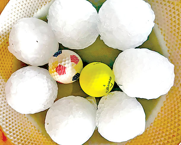
Balls of hail measuring as large as 2.5 inches in diameter, relatively the size of a human palm (see photo at right), ended the 4th of July weekend causing extensive damage around Yellowstone County.
The force behind the unprecedentedly large hail was heightened by high wind speeds, which gusted up to 53 miles per hour, according to the National Weather Service (NWS) in Billings.
A meteorologist with NWS stated that these types of thunderstorms are not uncommon for this area, but noted the timing was a bit strange. He explained that the Yellowstone County area has “tapped into a deeper moisture pool” this summer, and added, “we just have a lot more moisture [than usual] running over top of us.” It was reported by NWS that an irregular amount of energy – brought on by a trough to the northwest of this region – is the reason that such a tremendous storm occurred this early in the season.
Click HERE to Read Entire Story